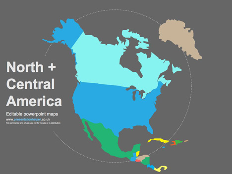
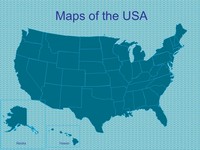
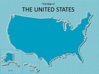
Free Editable Maps of North America
Editable Map PowerPoint Templates , 4th July, Geography, Labor Day, Maps, Memorial Day, USA
Free editable PowerPoint maps of North and Central America.
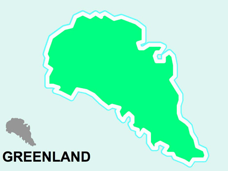
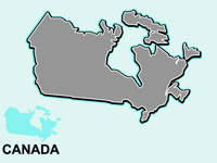
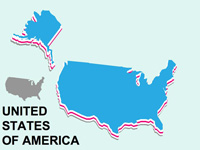
Here you will find the latest editions to our editable Vector PowerPoint map range. These maps include Canada, Greenland, USA, Mexico, Cuba, Jamaica and more. All these maps are fully editable and scalable in PowerPoint. We’ve included a few ideas on how you can modify these maps by using strokes and fills.
If you’re looking for maps of Europe please see our free PowerPoint maps – uk and europe, templates which also feature a tutorial on editing the maps.
You can also use the pins supplied with the European maps on these American ones to add place names and locations.
These templates are free for commercial and private use, but not for re-sale or re-distribution.
If you liked this PowerPoint Template we would appreciate you liking it on FaceBook or Tweeting it.
Published On: 20th Oct 2006
Read more about -Editable Map PowerPoint Templates , 4th July, Geography, Labor Day, Maps, Memorial Day, USA Template number 00252
Recommended Pages

-
[…] Editable maps of North and Central Amercia […]
-
is there anyone in here have Indonesia Map?
thanks
-puri- -
hey guys
could you do one of australia pls
that would be really good
-
I cannot download any of the maps… could you tell me if I need to have something special on my PC?? or may be I could not find them … where are downloaded?? C:\??
THX!
-
You should be able to download them now, our file went AWOL and now its back!
-
It would be super cool to have a vector map of all the US states, similar to the EU map on this site.
Anyone got one? Please?
-
Could you please do one on map of Asia.
Thanks
Lim -
[…] riutilizzabili e rieditabili, davvero utilissime per le ricerche scolastiche, con tutorial (link 1, link 2) per renderle ancora più personalizzabili, possibilità di intonarle alla nostra presentazione e […]
-
Dear all,
Thank you very much for all nice template. I do presentation for North America. I found your tempate and it’s very very propriate with me.But make it more choice.
-
Help! Has anybody got map of asia pacific in just black and white outline? Thanks
-
thanks for all the hard work in putting together a resource i can access and use for free. i appreciate the efforts put forth by everyone.
-
It would be great to have map of India in your list.
-
Is there a world map that I can use?
-
These maps are fantastic thanks very much
-
Where is the rest of the Americas?
-
any informatrion about marqui
-
i need a north America map fast, its for the job, does anyone kno where i can get one
-
[…] also have larger editable maps of the UK and Europe along with North America. If you liked this template we would appreciate some feedback on how you would like to use it. […]
-
Do you have an editable political map of Mexico?
-
[…] else where it might be helpful. At the moment we have maps of UK & Europe, also we have free editable PowerPoint maps of North America and now editable world […]
-
[…] else where it might be helpful. At the moment we have maps of UK & Europe, also we have free editable PowerPoint maps of North America and now editable world maps. If you liked this template we would appreciate some feedback on how […]
-
[…] or anywhere else where it might be helpful. At the moment we have maps of UK & Europe and also free editable PowerPoint maps of North America and now editable world maps If you liked this template we would appreciate some feedback on how […]
-
Could you make one of Peru please?
-
Nice. But Newfoundland is about 1000 kilometers north of where it should be.
-
Anyone has a editable US map by counties
Thanks so much
-
THANK YOU!!!
-
Can you do a map of Canada with the province outlines?
-
Thank you much for the good work. I have used your maps for years for powerpoint presentations and I like to put it on my website. Is that considered “free for commercial use”?
-
Many thanks, we are glad you like the templates. We have put a lot of work into developing all these templates and retain the copyright in them. They are not Open Source templates. You can use them freely providing that you do not redistribute or sell them.
Do
Use these templates for your presentations
Display your presentation on a web site provided that it is not for the purpose of downloading the template.
If you like these templates, we would always appreciate a link back to our website. Many thanks.Don’t
Resell or distribute these templates
Put these templates on a website for download. This includes uploading them onto file sharing networks like Slideshare, Myspace, Facebook, bit torrent etc
Pass off any of our created content as your own work.In answer, you can put a link to the templates on your website but cannot include a copy to download on your website!
-
I can see these coming in handy for an up and coming project we have.
Thankyou.
-
I relish, result in I found just what I used to be looking for.
You have ended my four day lengthy hunt! God Bless you man.
Have a great day. Bye -
Hello, just wanted to mention, I enjoyed this post.
It was practical. Keep on posting! -
This was amazing, after fumbling around for a while I came upon your site and was able to do exactly what I needed for my presentation. Thank you!
-
I appreciate, lead to I found exactly what I was taking
a look for. You’ve ended my four day lengthy hunt! God Bless you man. Have a nice day. Bye -
This is GREAT! THANK YOU!!!
-
it’d be nice to have something like “custom map” template – like paper/parchment on a wooden desk and map lines that can be moved, resized, colored, etc. would be nice. and probably clipart that can fit with it – mountain ranges, forests etc. just saying.
-
The template for USA and Central America seems to be missing.
-
Thank you!
-
Hi there, juyst wanted too tedll you, I lovedd this article.
It was inspiring. Keepp oon posting! -
Thank you for the map of the USA. I used it in a training manual. It was perfect.
-
Great resource! Thanks for sharing.
- Abstract
- Animal
- Animated
- Architecture
- Birthday
- Business
- Calendar
- Celebration
- Christmas
- Clip Art
- Maps
- Educational
- Engineering
- Flags
- Food and Drink
- Landmarks
- Medical
- Nature
- Pattern
- Science
- Shape
- Sport
- Transport
- Travel
- Valentines
- Weather
- Wedding
- Subtle Waves Template
- Business world map
- Filmstrip with Countdown
- Business 1
- Blue Bubbles
- Corporate 2
- Vector flowers template
- Filmstrip
- Editable PowerPoint newspapers
- Hands Template
- Red blood cells slide
- Circles Template on white
- Maps of America
- Light Streaks Business Template
- Zen stones template
- Heartbeat Template
- Web icons template
- Chalkboard