PowerPoint Maps of the USA
Editable Map PowerPoint Templates , 4th July, Editor's pick, Geography, Labor Day, Maps, Memorial Day, USA
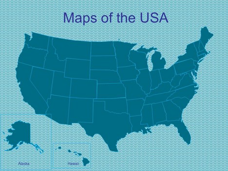
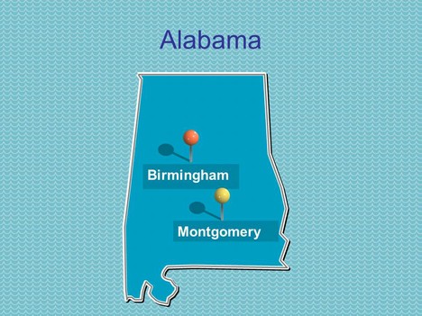
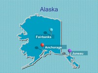
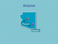
This free PowerPoint template shows the 50 states of the USA with their capitals and largest cities identified.
The templates include single slides for; Alabama, Alaska, Arizona, Arkansas, California, Colorado, Connecticut, Delaware, Florida, Georgia, Hawaii, Idaho, Illinois, Indiana, Iowa, Kansas, Kentucky, Louisiana, Maine, Maryland, Massachusetts, Michigan, Minnesota, Mississippi, Missouri, Montana, Nebraska, Nevada, New Hampshire, New Jersey, New Mexico, New York, North Carolina, North Dakota, Ohio, Oklahoma, Oregon, Pennsylvania, Rhode Island, South Carolina, South Dakota, Tennessee, Texas, Utah, Vermont, Virginia, Washington, West Virginia, Wisconsin and Wyoming.
It could be used as a teaching presentation for school or university. It could also be used for learning the states and capital cities of the United States of America, as part of a quiz, or for a presentation on travel.
Click here to see our other USA maps and USA templates. We also have a variety of maps of Canada, Mexico, Central America and the rest of the world.
If you have enjoyed using this template, please let us know in the comments box below, what you used it for.
If you liked this PowerPoint Template we would appreciate you liking it on FaceBook or Tweeting it.
Published On: 5th Jun 2022
Read more about -Editable Map PowerPoint Templates , 4th July, Editor's pick, Geography, Labor Day, Maps, Memorial Day, USA Template number 00557
-
Doing a presentation on document fraud prosecutions across the US, and I want folks to see how widespread the problem is, and does not exempt any state.
-
Please post copy right information. I’d like to use an image for my business card, but I need to know if this is okay.
-
GREAT!
-
The small company where I work has to give presentations once in a while that involve maps of the US and Canada with various states shaded different colors. For years we’ve been using Paint to do this – which is neither efficient nor particularly pretty. I think these templates will be very helpful to save time and improve our presentations. Thanks!
-
I seriously cannot thank you enough for these. I am in Year 7 and we are doing weather presentations (learning to say weather in French)!
These are going to just blow the teacher away!
THANX AGAIN!
LSR -
I am doing a research paper presentation and need this as a visual! Thank you so much!
-
Used for a quarterly sales meeting for 4 people.
-
Working with a team that covers the USA. Glad to have a map I can use to identify regions we cover. Thank You!
-
This is incredibly helpful for presentation purposes. I plan to use the maps for internal presentations, and for my own personal reference.
-
I’ve been looking for this I need to do a presentation about demography…I’m really thankfull
-
How do I remove the background?
-
Ah! got it — I just copied it into another presentation when I hid the background effects and it transferred over blank background!
-
This is awesome! I am hoping to use this in a presentation but would like to make the map smaller so I can have text above and to the side of the map. Has anyone had luck doing this? Thank you!
-
THANK YOU VERY MUCH!!! FANTASTIC HELP!
-
Thank you very much. That really helps!!!
-
I am a 2nd grade student, this was very helpful in my class presentation.Thanks!
-
This is exactly what I needed to create a US regional map specific to my organization, where I could color and label region one to our preference.
-
Thank you so much!
-
3/6/2017 Thanks so much for sharing (for free). Very appreciate your organization to do this.
-
perfect for any purpose when needing a US Map. Thanks so much. Wish I contribute.
-
Thanks for the slides. Pittsburgh is spelled wrong on the map of Pennsylvania (there’s an H at the end).
-
Hi Dave, thanks all changed over – apologies
-
My son is using this for his 2nd grade class project, using PowerPoint for the first time.
It is exactly the template he needs. What an impressive template you created. My son and I thank you very much for your efforts and time making this available. I am sure this helped a lot of people. -
Saved me a lot of time to bring in myself for presentation Thank you Nice work
-
This is so cool!!!! Thank you for making this!