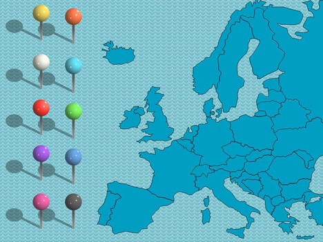
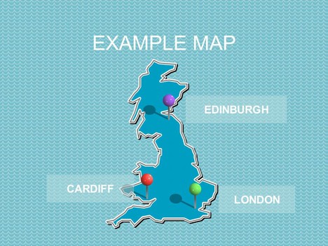
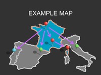
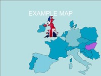
These are maps of individual countries with separate images of drawing pins. The vector maps include France, Italy, Germany, Holland, Spain, Portugal, Greece, Norway, Sweden, Finland, Denmark, Belgium, Ireland and the UK and more. With these templates you can insert the “pins” into places of interest and then label them as you wish.
These can be used in PowerPoint slides, in web pages and blogs, or anywhere else where they may be helpful.
If you liked this PowerPoint Template we would appreciate you liking it on FaceBook or Tweeting it.
Published On: 1st Dec 2011
Read more about -Editable Map PowerPoint Templates , Maps, UK Templates Template number 00633
-
Hey I like your slides very much. Still there is a need for some correction regarding the map of Europe as you have there Serbia and Montenegro as one country and they are two countries now.
Kind regards
JB -
Thanks very much! These are really useful and easy to manipulate for ppt and saved me masses of time.
It’d be nice to be able to change the pin colours in future. -
Thank’s a lot. This file is of the great use for drawing the routes in the presentations. It gives the ability to highlight different countries without using Photoshop.
-
SO fantastic… THANKS!
-
Wonderful resource, so grateful that these maps are available!
Thank you.
-
By the way, is there a way to decrease the size of the map. I can’t seem to do it in keynote. Thanks again. Anita
-
I dont have keynote but in powerpoint you would group all the objects in the map together (highlight them all, right click, group and group all objects) this then allows you to decrease the size of the map but still keep everything in proportion and in the right position.
-
Great use from the map of europe,
just passed it onto a colleague and it will serve in mapping out some interesting stuff. I love powerpont and presentation preparation and delivery. Let me know if you would need any help!
-
Hey guys,
Excellent job, and very useful.
No Middle East though! But thanks a lot, will certainly use these often down the road.
-
Nice! Really useful – thanks for this.
-
Really nice and useful, thanks very much!
-
Many thanks for this excellent map! Please could you add the island of Malta (EU member state)? It is missing from the map (just south of Sicily).
many thanks
-
Thank you very much for the europe map
-
Thank you very very much for this map! It’s awesome 🙂
-
Just what I needed, thanks a lot!
-
Hi,
What about the full map of Poland? Regards Agata 🙂
-
A BIG thank you for providing these maps – it saved me a lot of time. They are great! I’ve used the map of Germany. Will you be providing a map of Switzerland with the separate Cantons too?
-
I have searched everywhere for the perfect template and I have finally found it!!! Thank you so much 😀
-
Muy útil. Gracias.
-
Great tools. Thank you. Just what I needed.
-
Juste génialissime.
-
great website Thanks!
-
My son is doing a film documentary for an art exhibition, hopes to use the maps to show the expansion of the Venetian empire over time. Thanks!
-
Thanks for such great editable maps for free.. there are so many websites where on can get maps, but none where the maps are fully editable!! a million thanks guys!
-
Great job !!! Very helpful, just what I needed !!! Thanks !!!
-
Hey,
thank you very much for this template!
it helps me a lot:) -
An excellent resource. Had to put together a map for a proposal showing different EU participants. This saved me loads of time, thank you!
-
Can I get more pins? I’ve used the ones provided in template. Thanks in advance.
-
Do have Turkey anywhere as an editable map? Seems to be missing from both the Europe and Asia maps.
-
i think this is one of my favourite templates!
it would be very efficient for me to use when i present:) -
These maps (i.e., US, Canada, and Europe) are great! I have struggled to find visuals that are easily manipulated, like these. Your templates will save me a lot of time and will allow me to more clearly represent the status of my business in different territories/states/countries. Thanks!